Contents
Overview
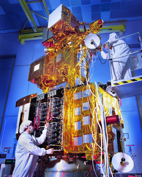
The launch of the first Landsat satellite, initially known as the Earth Resources Technology Satellite, was a groundbreaking moment in the history of Earth observation. The satellite was launched on July 23, 1972, and was later renamed to Landsat 1 in 1975. The success of the Landsat program can be attributed to the collaboration between NASA and the USGS. The program has been instrumental in providing valuable data for various applications, including agriculture, cartography, geology, forestry, and education. The images acquired by the Landsat satellites are archived in the United States and at Landsat receiving stations around the world, and can be accessed through the USGS 'EarthExplorer' website.
📸 How It Works
The Landsat satellites are equipped with advanced instruments that capture millions of images of the Earth's surface. The images are divided into scenes for easy downloading, with each scene covering an area of approximately 115 miles long and 115 miles wide. The spatial resolution of the images ranges from 15 to 60 meters, with a temporal resolution of 16 days. The data provided by the Landsat program has been used by various organizations, including the United Nations, the European Union, and the National Science Foundation. The program has also inspired the development of other Earth observation programs, such as the Sentinel-2 mission by the European Space Agency.
🌎 Cultural Impact
The cultural impact of the Landsat program cannot be overstated. The program has provided invaluable data for understanding the Earth's surface and has contributed significantly to global change research. The images acquired by the Landsat satellites have been used in various applications, including agriculture, cartography, geology, forestry, and education. The program has also inspired a new generation of scientists, researchers, and policymakers to work towards a better understanding of our planet. The Landsat program has been recognized for its contributions to the field of Earth observation, and has received numerous awards, including the NASA Exceptional Service Medal. The program has also been featured in various documentaries, including the PBS documentary 'Landsat: The Long Look'
🔮 Legacy & Future
The legacy of the Landsat program is a testament to the power of collaboration and innovation. The program has paved the way for future Earth observation missions, including the Landsat 9 mission. The data provided by the Landsat program will continue to be used by researchers, policymakers, and scientists to better understand our planet and address the challenges facing our world. As we look to the future, it is clear that the Landsat program will remain a vital component of our efforts to monitor and understand the Earth's surface. The program has also inspired the development of new technologies, such as the Google Earth platform, which has revolutionized the way we interact with geographic data.
Key Facts
- Year
- 1972
- Origin
- United States
- Category
- science
- Type
- technology
Frequently Asked Questions
What is the primary purpose of the Landsat program?
How often do the Landsat satellites capture images of the Earth's surface?
The Landsat satellites capture images of the Earth's surface every 16 days, with a spatial resolution ranging from 15 to 60 meters. The images are divided into scenes for easy downloading, with each scene covering an area of approximately 115 miles long and 115 miles wide.
What are some of the key applications of the Landsat program?
The Landsat program has various applications, including agriculture, cartography, geology, forestry, and education. The data provided by the program is used by organizations such as the United Nations, the European Union, and the National Science Foundation.
How has the Landsat program contributed to global change research?
The Landsat program has significantly contributed to global change research by providing valuable data on the Earth's surface. The program has helped scientists understand the impacts of climate change, deforestation, and urbanization on the environment. The data provided by the program has also been used to develop policies and strategies for sustainable development.
What is the future of the Landsat program?
The Landsat program will continue to play a vital role in Earth surface monitoring and global change research. The launch of Landsat 9 in 2021 ensures the continuation of the program's data collection and analysis. The program will also inspire the development of new technologies and applications, such as the Google Earth platform.