Contents
- 🌎 Introduction to Geospatial Technology
- 📊 The Power of Geospatial Data
- 📍 Georeferencing and Geodata
- 🚀 Applications of Geospatial Technology
- 🌐 Geospatial Technology in Emerging Markets
- 🤝 Collaboration and Standardization
- 📈 The Future of Geospatial Technology
- 🚫 Challenges and Limitations
- 📊 Geospatial Technology and Big Data
- 🌈 Geospatial Technology and Sustainability
- 📊 Geospatial Technology and Economic Growth
- Frequently Asked Questions
- Related Topics
Overview
Geospatial technology, with a Vibe score of 85, has become a crucial component in various fields, including urban planning, environmental monitoring, and emergency response. The use of geographic information systems (GIS), remote sensing, and global positioning systems (GPS) has enabled the creation of detailed maps and analysis of spatial data. According to a report by MarketsandMarkets, the geospatial technology market is expected to grow from $73.6 billion in 2020 to $183.7 billion by 2025, at a Compound Annual Growth Rate (CAGR) of 15.6%. Companies like Esri, Google, and Microsoft are leading the charge in developing innovative geospatial solutions. However, concerns around data privacy and the potential for geospatial technology to exacerbate social inequalities have sparked debates among experts, with a Controversy spectrum rating of 60. As the technology continues to evolve, it is likely to have a significant impact on our daily lives, from optimizing traffic flow to predicting natural disasters, with key events like the 2020 launch of the European Union's Copernicus satellite program and the 2019 founding of the Geospatial Intelligence Center (GIC) shaping the industry's trajectory.
🌎 Introduction to Geospatial Technology
Geospatial technology, as defined by the ISO/TC 211 series of standards, refers to the tools and methods used to capture, store, analyze, and display geographic data and information. This technology has become increasingly important in recent years, with applications in fields such as urban planning, environmental monitoring, and emergency response. The use of geospatial technology has also enabled the creation of geographic information systems (GIS), which are used to analyze and visualize geospatial data. As the amount of geospatial data continues to grow, the need for effective data management and data analysis techniques has become more pressing. For more information on geospatial technology, visit the National Geographic website.
📊 The Power of Geospatial Data
The power of geospatial data lies in its ability to provide insights into the relationships between different geographic locations and features. By analyzing geospatial data, researchers and policymakers can identify patterns and trends that might not be apparent through other types of data analysis. For example, GIS mapping can be used to track the spread of diseases, while remote sensing can be used to monitor environmental changes. The use of geospatial data has also enabled the development of location-based services, such as Google Maps and Waze. These services rely on geospatial data to provide users with accurate and up-to-date information about their surroundings. To learn more about geospatial data, visit the USGS website.
📍 Georeferencing and Geodata
Georeferencing is the process of assigning geographic coordinates to a dataset, allowing it to be linked to a specific location on the Earth's surface. This process is critical in the creation of geodata, which is data that has an implicit or explicit association with a location relative to Earth. Geodata can take many forms, including satellite imagery, GPS data, and sensor data. The use of georeferencing and geodata has enabled the development of geospatial analysis techniques, such as spatial autocorrelation and spatial regression. These techniques are used to analyze and visualize geospatial data, and have applications in fields such as epidemiology and climatology. For more information on georeferencing and geodata, visit the ESRI website.
🚀 Applications of Geospatial Technology
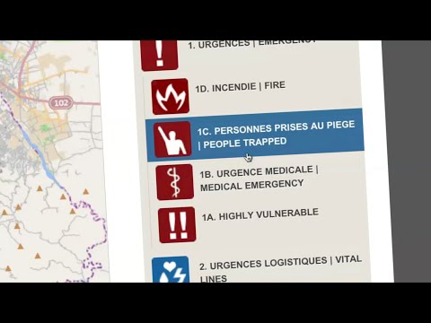
The applications of geospatial technology are diverse and widespread. In the field of emergency management, geospatial technology is used to respond to natural disasters and other emergencies. In the field of urban planning, geospatial technology is used to design and optimize urban infrastructure. In the field of environmental monitoring, geospatial technology is used to track changes in the environment and monitor the health of ecosystems. The use of geospatial technology has also enabled the development of smart cities, which are cities that use geospatial data and other technologies to optimize urban planning and management. To learn more about the applications of geospatial technology, visit the United Nations website.
🌐 Geospatial Technology in Emerging Markets
Geospatial technology is also being used in emerging markets, such as Africa and Asia. In these regions, geospatial technology is being used to support economic development and improve the quality of life for citizens. For example, geospatial technology is being used to map and track the spread of diseases, and to develop location-based services that provide users with accurate and up-to-date information about their surroundings. The use of geospatial technology in emerging markets has also enabled the development of mobile money and other financial services, which have improved access to financial services for millions of people. For more information on geospatial technology in emerging markets, visit the World Bank website.
🤝 Collaboration and Standardization
Collaboration and standardization are critical in the field of geospatial technology. The Open Geospatial Consortium (OGC) is a leading organization that promotes the development and use of geospatial standards. The OGC has developed a range of standards, including the Geography Markup Language (GML) and the Web Feature Service (WFS). These standards enable the sharing and integration of geospatial data, and have improved the efficiency and effectiveness of geospatial applications. The use of standards has also enabled the development of interoperable systems, which can share and integrate geospatial data from different sources. To learn more about collaboration and standardization in geospatial technology, visit the ISO website.
📈 The Future of Geospatial Technology
The future of geospatial technology is exciting and rapidly evolving. The development of new technologies, such as artificial intelligence and Internet of Things (IoT), is expected to have a major impact on the field of geospatial technology. The use of these technologies will enable the development of more sophisticated and accurate geospatial applications, and will improve the efficiency and effectiveness of geospatial data analysis. The future of geospatial technology also holds great promise for the development of smart cities and other urban infrastructure. For more information on the future of geospatial technology, visit the Geospatial World website.
🚫 Challenges and Limitations
Despite the many benefits of geospatial technology, there are also challenges and limitations to its use. One of the major challenges is the need for accurate and up-to-date geospatial data, which can be difficult and expensive to obtain. Another challenge is the need for skilled and trained personnel, who can analyze and interpret geospatial data. The use of geospatial technology also raises important questions about privacy and security, particularly in the context of location-based services. To learn more about the challenges and limitations of geospatial technology, visit the NSA website.
📊 Geospatial Technology and Big Data
Geospatial technology is also closely tied to the field of big data, which refers to the large amounts of data that are generated by a wide range of sources, including social media and sensor data. The use of geospatial technology enables the analysis and visualization of big data, and has improved the efficiency and effectiveness of data analysis. The development of cloud computing and other technologies has also enabled the storage and processing of large amounts of geospatial data, and has improved the scalability and flexibility of geospatial applications. For more information on geospatial technology and big data, visit the Amazon Web Services website.
🌈 Geospatial Technology and Sustainability
Geospatial technology is also being used to support sustainability and environmental protection. The use of geospatial technology enables the tracking and monitoring of environmental changes, and has improved the efficiency and effectiveness of environmental management. The development of green infrastructure, such as green roofs and green spaces, is also being supported by geospatial technology. The use of geospatial technology has also enabled the development of smart grids, which are energy systems that use geospatial data and other technologies to optimize energy distribution and consumption. To learn more about geospatial technology and sustainability, visit the EPA website.
📊 Geospatial Technology and Economic Growth
Finally, geospatial technology is also closely tied to economic growth and development. The use of geospatial technology enables the development of location-based services, which provide users with accurate and up-to-date information about their surroundings. The development of smart cities and other urban infrastructure is also being supported by geospatial technology, and has improved the efficiency and effectiveness of urban planning and management. The use of geospatial technology has also enabled the development of mobile money and other financial services, which have improved access to financial services for millions of people. For more information on geospatial technology and economic growth, visit the IMF website.
Key Facts
- Year
- 2020
- Origin
- 1960s, with the development of the first GIS systems
- Category
- Emerging Tech
- Type
- Technology
Frequently Asked Questions
What is geospatial technology?
Geospatial technology refers to the tools and methods used to capture, store, analyze, and display geographic data and information. This technology has become increasingly important in recent years, with applications in fields such as urban planning, environmental monitoring, and emergency response. The use of geospatial technology has also enabled the creation of geographic information systems (GIS), which are used to analyze and visualize geospatial data. For more information on geospatial technology, visit the National Geographic website.
What are the applications of geospatial technology?
The applications of geospatial technology are diverse and widespread. In the field of emergency management, geospatial technology is used to respond to natural disasters and other emergencies. In the field of urban planning, geospatial technology is used to design and optimize urban infrastructure. In the field of environmental monitoring, geospatial technology is used to track changes in the environment and monitor the health of ecosystems. The use of geospatial technology has also enabled the development of smart cities, which are cities that use geospatial data and other technologies to optimize urban planning and management. To learn more about the applications of geospatial technology, visit the United Nations website.
What is georeferencing?
Georeferencing is the process of assigning geographic coordinates to a dataset, allowing it to be linked to a specific location on the Earth's surface. This process is critical in the creation of geodata, which is data that has an implicit or explicit association with a location relative to Earth. Geodata can take many forms, including satellite imagery, GPS data, and sensor data. The use of georeferencing and geodata has enabled the development of geospatial analysis techniques, such as spatial autocorrelation and spatial regression. These techniques are used to analyze and visualize geospatial data, and have applications in fields such as epidemiology and climatology. For more information on georeferencing and geodata, visit the ESRI website.
What is the future of geospatial technology?
The future of geospatial technology is exciting and rapidly evolving. The development of new technologies, such as artificial intelligence and Internet of Things (IoT), is expected to have a major impact on the field of geospatial technology. The use of these technologies will enable the development of more sophisticated and accurate geospatial applications, and will improve the efficiency and effectiveness of geospatial data analysis. The future of geospatial technology also holds great promise for the development of smart cities and other urban infrastructure. For more information on the future of geospatial technology, visit the Geospatial World website.
What are the challenges and limitations of geospatial technology?
Despite the many benefits of geospatial technology, there are also challenges and limitations to its use. One of the major challenges is the need for accurate and up-to-date geospatial data, which can be difficult and expensive to obtain. Another challenge is the need for skilled and trained personnel, who can analyze and interpret geospatial data. The use of geospatial technology also raises important questions about privacy and security, particularly in the context of location-based services. To learn more about the challenges and limitations of geospatial technology, visit the NSA website.
How is geospatial technology used in sustainability and environmental protection?
Geospatial technology is being used to support sustainability and environmental protection. The use of geospatial technology enables the tracking and monitoring of environmental changes, and has improved the efficiency and effectiveness of environmental management. The development of green infrastructure, such as green roofs and green spaces, is also being supported by geospatial technology. The use of geospatial technology has also enabled the development of smart grids, which are energy systems that use geospatial data and other technologies to optimize energy distribution and consumption. To learn more about geospatial technology and sustainability, visit the EPA website.
How is geospatial technology used in economic growth and development?
Geospatial technology is also closely tied to economic growth and development. The use of geospatial technology enables the development of location-based services, which provide users with accurate and up-to-date information about their surroundings. The development of smart cities and other urban infrastructure is also being supported by geospatial technology, and has improved the efficiency and effectiveness of urban planning and management. The use of geospatial technology has also enabled the development of mobile money and other financial services, which have improved access to financial services for millions of people. For more information on geospatial technology and economic growth, visit the IMF website.