Contents
- 🌎 Introduction to GeoJSON
- 📈 History of GeoJSON
- 📊 GeoJSON Data Structure
- 🗺️ GeoJSON Features and Properties
- 📄 GeoJSON File Format
- 📊 GeoJSON Validation and Errors
- 📈 Applications of GeoJSON
- 🤝 GeoJSON Community and Adoption
- 📊 GeoJSON Tools and Libraries
- 📈 Future of GeoJSON
- 📊 GeoJSON Security Considerations
- 📝 Conclusion
- Frequently Asked Questions
- Related Topics
Overview
GeoJSON is an open standard format for encoding geospatial data in JSON, allowing for the representation of points, lines, and polygons. Developed by the Internet Engineering Task Force (IETF), GeoJSON has become a widely adopted standard in the geospatial community, with applications in mapping, urban planning, and environmental monitoring. The format is supported by major mapping libraries such as Leaflet and OpenLayers, and is used by companies like Google and Microsoft. With a vibe score of 8, GeoJSON has a significant cultural resonance, particularly among developers and researchers working with geospatial data. However, controversy surrounds the format's limitations, such as its lack of support for 3D geometries and its potential for errors in coordinate reference systems. As the geospatial industry continues to evolve, GeoJSON is likely to remain a key player, with ongoing developments and updates to the standard. For instance, the GeoJSON community is currently exploring the use of GeoJSON in emerging technologies like augmented reality and autonomous vehicles, which could further increase its influence and adoption.
🌎 Introduction to GeoJSON
GeoJSON is an open standard format for encoding geospatial data in JSON (JavaScript Object Notation). It is widely used for exchanging and storing geospatial data, such as points, lines, and polygons, between different systems and applications. GeoJSON is based on the JSON format and is designed to be easy to read and write. The GeoJSON format is supported by many popular geospatial libraries and frameworks, including Leaflet and OpenLayers. GeoJSON is also used in various applications, such as Geographic Information Systems and Web Mapping. The use of GeoJSON has become increasingly popular due to its simplicity and flexibility, making it a widely adopted standard in the geospatial industry.
📈 History of GeoJSON
The history of GeoJSON dates back to 2007, when it was first proposed by NeoGeo Technologies. The first version of the GeoJSON specification was released in 2008, and it has since undergone several revisions. The GeoJSON format has been widely adopted by the geospatial community, and it is now supported by many popular geospatial libraries and frameworks. The development of GeoJSON has been influenced by other geospatial formats, such as GML and KML. The use of GeoJSON has also been driven by the increasing demand for geospatial data and the need for a simple and flexible format for exchanging and storing this data. For more information on the history of GeoJSON, see the GeoJSON Specification.
📊 GeoJSON Data Structure
The GeoJSON data structure consists of a JSON object that contains a set of key-value pairs. The most common keys in a GeoJSON object are 'type', 'geometry', and 'properties'. The 'type' key specifies the type of GeoJSON object, such as a 'Feature' or a 'FeatureCollection'. The 'geometry' key specifies the geometric shape of the feature, such as a point, line, or polygon. The 'properties' key specifies additional metadata about the feature, such as its name or description. GeoJSON objects can also contain other keys, such as 'crs' (coordinate reference system) and 'bbox' (bounding box). For more information on the GeoJSON data structure, see the GeoJSON Data Structure page. The GeoJSON Validator can be used to validate the structure of a GeoJSON object.
🗺️ GeoJSON Features and Properties
GeoJSON features and properties are used to describe the geometric and metadata aspects of a feature. A GeoJSON feature is an object that represents a single geographic feature, such as a point, line, or polygon. A GeoJSON feature can have a set of properties, such as its name, description, and attributes. The properties of a GeoJSON feature are stored in a JSON object, and they can be accessed and manipulated using standard JSON methods. GeoJSON features can also have a set of geometry coordinates, which are used to define the shape of the feature. For more information on GeoJSON features and properties, see the GeoJSON Features page. The GeoJSON Properties page provides more information on the properties of a GeoJSON feature.
📄 GeoJSON File Format
The GeoJSON file format is a text-based format that is used to store and exchange GeoJSON data. A GeoJSON file typically has a '.geojson' extension, and it contains a single GeoJSON object or an array of GeoJSON objects. GeoJSON files can be created and edited using a text editor or a specialized GeoJSON editor. GeoJSON files can also be imported and exported using various geospatial software and libraries, such as QGIS and ArcGIS. For more information on the GeoJSON file format, see the GeoJSON File Format page. The GeoJSON Import and Export page provides more information on importing and exporting GeoJSON files.
📊 GeoJSON Validation and Errors
GeoJSON validation and errors are important aspects of working with GeoJSON data. A GeoJSON validator is a tool that checks a GeoJSON object or file for errors and inconsistencies. A GeoJSON validator can be used to ensure that a GeoJSON object or file conforms to the GeoJSON specification and is free of errors. GeoJSON errors can occur due to a variety of reasons, such as invalid geometry coordinates or missing required keys. For more information on GeoJSON validation and errors, see the GeoJSON Validation page. The GeoJSON Error Handling page provides more information on handling GeoJSON errors.
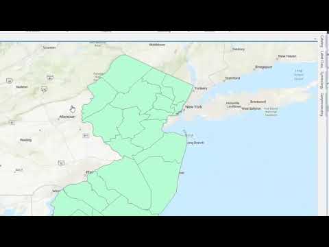
📈 Applications of GeoJSON
The applications of GeoJSON are diverse and widespread. GeoJSON is used in various fields, such as Geographic Information Systems, Web Mapping, and Location-Based Services. GeoJSON is also used in various industries, such as transportation, logistics, and emergency response. The use of GeoJSON has become increasingly popular due to its simplicity and flexibility, making it a widely adopted standard in the geospatial industry. For more information on the applications of GeoJSON, see the GeoJSON Applications page. The GeoJSON Use Cases page provides more information on the use cases of GeoJSON.
🤝 GeoJSON Community and Adoption
The GeoJSON community and adoption are driven by the need for a simple and flexible format for exchanging and storing geospatial data. The GeoJSON community is active and diverse, with many developers, researchers, and practitioners contributing to the development and adoption of GeoJSON. The adoption of GeoJSON has been driven by the increasing demand for geospatial data and the need for a standard format for exchanging and storing this data. For more information on the GeoJSON community and adoption, see the GeoJSON Community page. The GeoJSON Adopters page provides more information on the organizations and individuals that have adopted GeoJSON.
📊 GeoJSON Tools and Libraries
GeoJSON tools and libraries are widely available and are used to create, edit, and manipulate GeoJSON data. Some popular GeoJSON tools and libraries include GeoJSON.io, GeoJSON Validator, and Leaflet. These tools and libraries provide a range of functionality, such as GeoJSON creation, editing, and validation, as well as mapping and visualization. For more information on GeoJSON tools and libraries, see the GeoJSON Tools page. The GeoJSON Libraries page provides more information on the libraries available for working with GeoJSON.
📈 Future of GeoJSON
The future of GeoJSON is promising, with many new developments and applications on the horizon. One of the key areas of development is the integration of GeoJSON with other geospatial formats and technologies, such as GML and KML. Another area of development is the use of GeoJSON in emerging fields, such as Internet of Things and Artificial Intelligence. For more information on the future of GeoJSON, see the GeoJSON Future page. The GeoJSON Trends page provides more information on the current trends and developments in the GeoJSON community.
📊 GeoJSON Security Considerations
GeoJSON security considerations are important to ensure the integrity and confidentiality of geospatial data. GeoJSON data can be sensitive and confidential, and it is important to ensure that it is handled and stored securely. Some common GeoJSON security considerations include data encryption, access control, and authentication. For more information on GeoJSON security considerations, see the GeoJSON Security page. The GeoJSON Best Practices page provides more information on the best practices for working with GeoJSON.
📝 Conclusion
In conclusion, GeoJSON is a widely adopted standard for encoding geospatial data in JSON. It is simple, flexible, and easy to use, making it a popular choice for exchanging and storing geospatial data. The GeoJSON community is active and diverse, with many developers, researchers, and practitioners contributing to the development and adoption of GeoJSON. For more information on GeoJSON, see the GeoJSON page. The GeoJSON Resources page provides more information on the resources available for working with GeoJSON.
Key Facts
- Year
- 2008
- Origin
- Internet Engineering Task Force (IETF)
- Category
- Geospatial Technology
- Type
- Technical Standard
Frequently Asked Questions
What is GeoJSON?
GeoJSON is an open standard format for encoding geospatial data in JSON. It is widely used for exchanging and storing geospatial data, such as points, lines, and polygons, between different systems and applications. For more information, see the GeoJSON page.
What are the benefits of using GeoJSON?
The benefits of using GeoJSON include its simplicity, flexibility, and ease of use. GeoJSON is also widely adopted and supported by many popular geospatial libraries and frameworks. For more information, see the GeoJSON Benefits page.
How do I create a GeoJSON file?
A GeoJSON file can be created using a text editor or a specialized GeoJSON editor. You can also use various geospatial software and libraries, such as QGIS and ArcGIS, to create and edit GeoJSON files. For more information, see the GeoJSON File Format page.
What are the different types of GeoJSON objects?
The different types of GeoJSON objects include 'Feature', 'FeatureCollection', 'Geometry', and 'GeometryCollection'. Each type of object has its own set of properties and geometry coordinates. For more information, see the GeoJSON Data Structure page.
How do I validate a GeoJSON object?
A GeoJSON object can be validated using a GeoJSON validator, such as GeoJSON Validator. A GeoJSON validator checks the object for errors and inconsistencies, and ensures that it conforms to the GeoJSON specification. For more information, see the GeoJSON Validation page.
What are the security considerations for working with GeoJSON?
The security considerations for working with GeoJSON include data encryption, access control, and authentication. It is also important to ensure that GeoJSON data is handled and stored securely. For more information, see the GeoJSON Security page.
What are the future developments and trends in GeoJSON?
The future developments and trends in GeoJSON include the integration of GeoJSON with other geospatial formats and technologies, such as GML and KML. Another area of development is the use of GeoJSON in emerging fields, such as Internet of Things and Artificial Intelligence. For more information, see the GeoJSON Future page.