Contents
Overview
The concept of a 'valley' as a geological feature is as old as the Earth's surface itself, with its formation being a continuous process over eons. Early humans likely recognized and utilized valleys for shelter, water sources, and travel routes, with evidence of early settlements found in numerous river valleys worldwide. Geographers and geologists began formally classifying and studying valleys during the Enlightenment. The recognition of glacial erosion's role in shaping valleys, particularly the distinctive U-shape, gained prominence in the 19th century. Rift valleys, formed by tectonic forces, were later understood through the development of plate tectonics theory in the mid-20th century, notably by scientists like Alfred Wegener (though his continental drift theory predated full acceptance of plate tectonics) and later refined by researchers at institutions like the Lamont-Doherty Earth Observatory.
⚙️ How It Works
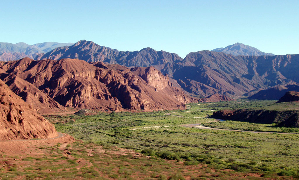
Valleys are primarily formed through erosion, a process that wears down and transports rock and soil. Fluvial valleys, the most common type, are carved by the persistent flow of rivers and streams. Glacial valleys are sculpted by the immense power of moving ice sheets or glaciers. Tectonic forces can also create valleys, most notably rift valleys, which form when the Earth's crust stretches and breaks apart, causing blocks of land to subside between fault lines, such as the East African Rift. Dry valleys, common in arid regions or areas with porous bedrock like limestone, occur where surface water has ceased to flow or has been diverted underground, leaving behind an empty channel carved by past water activity.
📊 Key Facts & Numbers
Globally, valleys are ubiquitous, covering an estimated 20% of the Earth's land surface. The Amazon River basin alone contains a vast network of valleys. The fjords of Norway are glacially carved valleys that extend below sea level. The Grand Canyon, a testament to fluvial erosion, is approximately 446 kilometers long, up to 29 kilometers wide, and reaches a depth of over 1.8 kilometers. Rift valleys are significant geological features; the East African Rift Valley system stretches for over 6,400 kilometers and is widening at a rate of approximately 6-7 millimeters per year, according to studies by the Geological Society of America.
👥 Key People & Organizations
While no single individual 'invented' the valley, numerous scientists and explorers have significantly contributed to our understanding of their formation and significance. James Hutton, often called the 'father of modern geology,' revolutionized our understanding of Earth's deep time and erosional processes in the late 18th century, influencing how valleys were viewed. Louis Agassiz's 19th-century work on glaciers provided crucial insights into the formation of U-shaped valleys and fjords. In the 20th century, geologists like Tanya Atwater contributed to understanding tectonic landscapes, including rift valleys. Organizations such as the United States Geological Survey (USGS) and the British Geological Survey continuously map and study valleys worldwide, providing essential data for resource management and hazard assessment. The National Geographic Society has also played a significant role in popularizing the study and appreciation of these geological features through its publications and expeditions.
🌍 Cultural Impact & Influence
Valleys have profoundly shaped human civilization, serving as cradles for early settlements due to their fertile soils, reliable water sources, and natural protection. The Nile River Valley in Egypt, the Fertile Crescent between the Tigris and Euphrates rivers, and the Indus River Valley are prime examples where agriculture and complex societies first flourished. Their linear nature often dictated the routes of early roads and railways, connecting communities and facilitating trade. In art and literature, valleys have been depicted as places of solitude, beauty, and sometimes danger, inspiring countless paintings, poems, and stories. The iconic imagery of a winding river through a verdant valley or a dramatic mountain gorge has become a recurring motif in Western romanticism and landscape art, exemplified by artists like Albert Bierstadt and John Constable.
⚡ Current State & Latest Developments
The study and appreciation of valleys continue to evolve with advancements in remote sensing and geographic information systems (GIS). Technologies like satellite imagery and LiDAR (Light Detection and Ranging) allow for highly detailed mapping and analysis of valley morphology and erosion rates, providing unprecedented insights for geologists and environmental scientists. For example, ongoing monitoring of the East African Rift Valley by institutions like the University of Oxford uses seismic data and GPS measurements to track tectonic activity and predict future landscape changes. Furthermore, conservation efforts are increasingly focused on protecting valley ecosystems, which often harbor unique biodiversity and are vulnerable to human development and climate change. The recent recognition of the ecological importance of valley floodplains by organizations like the World Wildlife Fund highlights their critical role in water management and habitat preservation.
🤔 Controversies & Debates
One persistent debate in geomorphology concerns the relative dominance of fluvial versus tectonic forces in shaping specific valley systems, particularly in tectonically active regions. While erosion is widely accepted as the primary mechanism, the precise interplay and timing of tectonic uplift and erosional downcutting can be complex and difficult to disentangle. Another area of discussion involves the classification of valley types; while broad categories like V-shaped (fluvial) and U-shaped (glacial) are standard, the spectrum of intermediate forms and local variations often leads to nuanced debates among geographers. The impact of climate change on valley erosion rates is also a subject of ongoing research, with concerns that increased extreme weather events could accelerate landscape modification in many regions, a topic frequently discussed in journals like Nature Geoscience.
🔮 Future Outlook & Predictions
The future of valleys is intrinsically linked to global climate patterns and ongoing geological processes. Climate change is predicted to alter precipitation regimes, potentially increasing the erosive power of rivers in some regions while leading to desiccation and dry valley formation in others. Glacial valleys in high-altitude and polar regions are particularly vulnerable, with melting glaciers threatening to reshape these landscapes and impact downstream water availability, as documented by the Intergovernmental Panel on Climate Change (IPCC). Tectonic activity will continue to shape rift valleys, with ongoing research aiming to better predict seismic and volcanic hazards associated with these zones. Furthermore, as human populations continue to grow, the pressure to develop valley floors for agriculture, infrastructure, and urban expansion will intensify, necessitating careful land-use planning and sustainable management strategies to balance human needs with ecological preservation.
💡 Practical Applications
Valleys are fundamental to human settlement and resource utilization. Their fertile alluvial soils are prime agricultural land, supporting crops and liv
Key Facts
- Category
- nature
- Type
- topic