Contents
Overview
The concept of 'land surface' as a subject of study predates formal scientific disciplines, with ancient civilizations observing and mapping the lay of the land for practical reasons like agriculture and navigation. Early geographers like Strabo described the varied topography of the known world in his work Geographica. The formalization of terrain analysis, however, gained momentum during the Enlightenment and the subsequent rise of physical geography. Pioneers like Alexander von Humboldt meticulously documented elevation and geological formations during his expeditions in the Americas, laying groundwork for systematic study. The development of cartography and surveying techniques in the 19th century, particularly with the advent of tools like the theodolite, allowed for more precise mapping of surface features, moving beyond mere description to quantitative analysis. The 20th century saw the integration of geological principles, leading to theories of plate tectonics which explained the large-scale formation of mountains and basins, fundamentally altering our understanding of how land surfaces are created and modified over geological timescales.
⚙️ How It Works
The land surface is a product of continuous interaction between internal geological forces and external environmental processes. Endogenic forces, driven by heat from the Earth's interior, manifest as plate tectonics, leading to the uplift of mountain ranges like the Himalayas and the formation of rift valleys. Volcanic activity, another endogenic process, creates new landforms such as cones and plateaus. Exogenic forces, primarily driven by solar energy and gravity, then act upon these initial forms. Weathering breaks down rocks, while erosion, facilitated by agents like water (rivers, glaciers, oceans), wind, and ice, transports material, carving valleys, shaping coastlines, and depositing sediments to form plains and deltas. Geomorphology is the scientific discipline dedicated to studying these processes and the resulting landforms, analyzing factors like slope, aspect, and curvature to understand water flow, soil development, and habitat creation. The interplay between these forces creates the diverse and complex topography we observe globally.
📊 Key Facts & Numbers
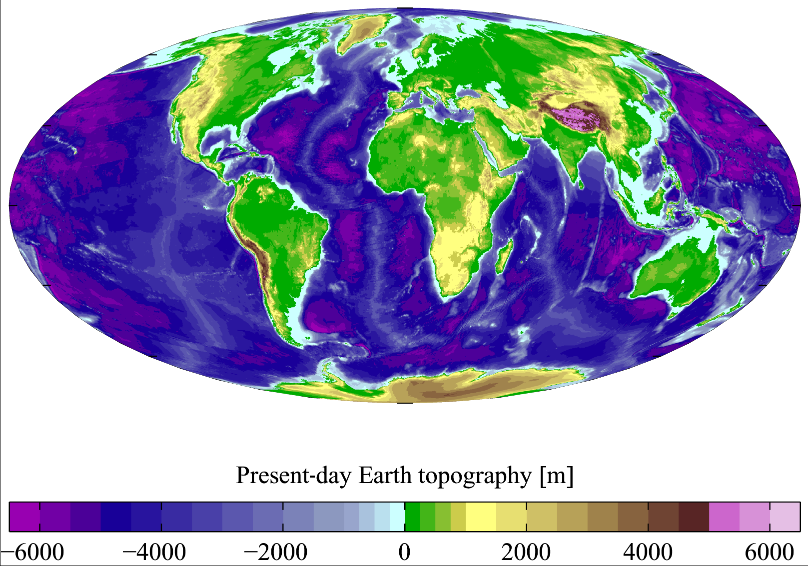
The Earth's land surface exhibits staggering variations in elevation. The Andes is a mountain range that can span thousands of kilometers. The Amazon River basin experiences erosion rates that contribute substantially to sediment transport into the Atlantic Ocean. Globally, approximately 70% of the land surface is considered to be within 1 km (0.62 mi) of a river or stream, highlighting the pervasive influence of hydrology on shaping the terrain.
👥 Key People & Organizations
Key figures in the study of land surface include Strabo, whose ancient geographical descriptions laid early conceptual groundwork, and Alexander von Humboldt, who pioneered systematic field observations of topography and geology. Modern geomorphology owes much to scientists like William Morris Davis, often called the 'father of American geomorphology,' who developed the concept of the erosional cycle or 'Davisian cycle.' Organizations such as the International Union of Geodesy and Geophysics (IUGG) and its affiliated International Association of Geomorphologists (IAG) play crucial roles in advancing research and fostering international collaboration. National geological surveys, like the United States Geological Survey (USGS) and the British Geological Survey, are instrumental in mapping, monitoring, and understanding the land surface within their respective countries, providing essential data for scientific research and public policy. Remote sensing agencies, including NASA and the European Space Agency (ESA), utilize satellite technology to gather global data on land surface characteristics.
🌍 Cultural Impact & Influence
The land surface has profoundly influenced human civilization, shaping settlement patterns, agricultural practices, and cultural development. The fertile river valleys of Mesopotamia fostered the rise of early civilizations due to their arable land and water resources. Mountainous regions, while posing challenges, have often led to distinct cultural adaptations and isolated communities, as seen in the Swiss Alps or the Caucasus Mountains. The aesthetic qualities of landforms have inspired countless artists, writers, and poets, from the Romantic landscape painters like J.M.W. Turner to the epic descriptions of terrain in literature. The perception of land surface also carries symbolic weight; mountains are often associated with divinity or challenge, while plains can represent vastness or opportunity. The way humans interact with and perceive their land surface is deeply embedded in their cultural identity and worldview.
⚡ Current State & Latest Developments
Current developments in understanding land surface are heavily driven by advancements in remote sensing and geographic information systems (GIS). Technologies like LiDAR (Light Detection and Ranging) and high-resolution satellite imagery from platforms such as Google Earth and Maxar Technologies provide unprecedented detail for mapping and analyzing terrain, even beneath dense forest canopies. Machine learning and artificial intelligence are increasingly being applied to process vast datasets, enabling automated landform classification, erosion modeling, and prediction of landslide susceptibility. The study of the Anthropocene highlights the significant and accelerating impact of human activities—urbanization, deforestation, agriculture, and mining—on shaping and altering the global land surface, often at rates exceeding natural geological processes. Monitoring these changes is critical for environmental management and disaster risk reduction.
🤔 Controversies & Debates
One of the most persistent debates in geomorphology revolves around the relative importance of tectonic uplift versus erosional processes in shaping large-scale landforms. While plate tectonics undeniably creates the initial relief, the extent to which erosion (driven by climate and hydrology) can 'keep pace' with uplift and influence the overall morphology of mountain belts remains a subject of ongoing research and modeling. Another area of contention is the precise quantification of human impact on land surface processes. While the overall influence is clear, attributing specific changes to human activities versus natural variability, especially over shorter timescales, can be challenging. Furthermore, the ethical implications of altering natural land surfaces for development or resource extraction, and the prioritization of conservation versus exploitation, represent significant societal and political debates.
🔮 Future Outlook & Predictions
The future of land surface analysis will likely involve even greater integration of multi-source data, including ground-based sensors, drone imagery, and advanced satellite observations, leading to near real-time monitoring of dynamic processes like erosion and mass wasting. Predictive modeling will become more sophisticated, leveraging AI to forecast the impact of climate change on land surface evolution, such as sea-level rise effects on coastal morphology and increased landslide risk in mountainous regions due to altered precipitation patterns. The concept of 'digital twins' for landscapes, creating virtual replicas of specific areas to simulate various scenarios, is also emerging. As human populations grow and re
Key Facts
- Category
- nature
- Type
- topic