Contents
- 🌎 Introduction to Geospatial Data
- 📊 Types of Geospatial Data
- 📍 Georeferencing and Spatial Analysis
- 🌐 Applications of Geospatial Data
- 🚀 Remote Sensing and Satellite Imagery
- 📈 Big Data and Geospatial Analytics
- 🤝 Collaboration and Data Sharing
- 🚫 Challenges and Limitations of Geospatial Data
- 🔍 Geospatial Data and Artificial Intelligence
- 📊 Future of Geospatial Data and Technology
- 🌟 Geospatial Data in Real-World Scenarios
- 📚 Conclusion and Further Reading
- Frequently Asked Questions
- Related Topics
Overview
Geospatial data, which encompasses the collection, analysis, and interpretation of location-based information, has become a crucial component of modern decision-making. With the rise of GPS, satellite imaging, and IoT sensors, the volume and variety of geospatial data have exploded, enabling applications such as precision agriculture, smart city planning, and climate modeling. However, this increased reliance on geospatial data also raises concerns about data privacy, accuracy, and the potential for biased decision-making. As geospatial data continues to shape our understanding of the world, it is essential to consider the tensions between its benefits and drawbacks. For instance, the use of geospatial data in urban planning can lead to more efficient transportation systems, but it also risks exacerbating existing social inequalities. Furthermore, the increasing importance of geospatial data has led to the emergence of new industries and job roles, such as geospatial analysts and location intelligence specialists. As the field continues to evolve, it is likely that we will see significant advancements in areas like autonomous vehicles and environmental monitoring, with companies like Esri and Google leading the charge.
🌎 Introduction to Geospatial Data
Geospatial data, as defined in the ISO/TC 211 series of standards, refers to data and information having an implicit or explicit association with a location relative to Earth. This type of data is also known as georeferenced data and information, geodata and geoinformation. The use of geospatial data has become increasingly important in various fields, including urban planning, environmental monitoring, and emergency response. With the help of Geographic Information Systems (GIS), geospatial data can be analyzed and visualized to gain valuable insights. For instance, Google Maps uses geospatial data to provide accurate directions and location-based services.
📊 Types of Geospatial Data
There are several types of geospatial data, including vector data and raster data. Vector data represents the world using points, lines, and polygons, while raster data represents the world as a grid of pixels. LiDAR (Light Detection and Ranging) is another type of geospatial data that uses laser pulses to create high-resolution 3D models of the environment. Additionally, GPS (Global Positioning System) provides location data that can be used to track the movement of people, vehicles, and other objects. Geospatial databases are used to store and manage large amounts of geospatial data.
📍 Georeferencing and Spatial Analysis
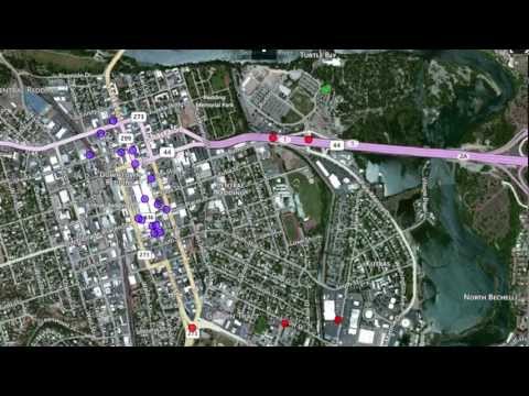
Georeferencing is the process of assigning spatial coordinates to geospatial data, allowing it to be analyzed and visualized in a spatial context. Spatial analysis is the process of examining the relationships between different variables in a spatial context. This can involve the use of spatial statistics and spatial modeling techniques. For example, crime mapping uses geospatial data and spatial analysis to identify patterns and trends in crime. Transportation planning also relies heavily on geospatial data and spatial analysis to optimize routes and reduce congestion.
🌐 Applications of Geospatial Data
Geospatial data has a wide range of applications, including natural resource management, disaster response, and urban planning. Precision agriculture uses geospatial data to optimize crop yields and reduce waste. Emergency response teams use geospatial data to quickly respond to emergencies and allocate resources. Smart cities initiatives also rely on geospatial data to create more efficient and sustainable urban environments. Geospatial consulting firms provide expertise and services to organizations looking to leverage geospatial data.
🚀 Remote Sensing and Satellite Imagery
Remote sensing and satellite imagery are important sources of geospatial data. Satellite imagery can be used to monitor environmental changes, track weather patterns, and detect natural disasters. Drone technology is also being used to collect high-resolution aerial imagery and create detailed 3D models of the environment. Earth observation satellites provide valuable data on the health of our planet, including climate change and deforestation. Geospatial intelligence agencies use remote sensing and satellite imagery to gather information on potential security threats.
📈 Big Data and Geospatial Analytics
The increasing amount of geospatial data being generated has led to the development of big data and geospatial analytics. Big data analytics involves the use of advanced statistical and computational methods to extract insights from large datasets. Geospatial machine learning is a subfield of machine learning that focuses on the analysis of geospatial data. Cloud computing provides the infrastructure needed to store and process large amounts of geospatial data. Geospatial data science is an interdisciplinary field that combines geospatial data analysis with other fields such as computer science and statistics.
🤝 Collaboration and Data Sharing
Collaboration and data sharing are essential for the effective use of geospatial data. Data sharing involves the exchange of geospatial data between organizations and individuals. Geospatial standards provide a common framework for the collection, storage, and dissemination of geospatial data. Open-source GIS software provides a cost-effective alternative to proprietary GIS software. Geospatial communities provide a platform for professionals and enthusiasts to share knowledge and collaborate on projects.
🚫 Challenges and Limitations of Geospatial Data
Despite the many benefits of geospatial data, there are also several challenges and limitations. Data quality is a major concern, as geospatial data can be affected by errors and inconsistencies. Data privacy is another concern, as geospatial data can be used to track the movement of individuals. Geospatial literacy is the ability to understand and work with geospatial data, and is an essential skill for professionals working in the field. Geospatial education provides training and resources for individuals looking to develop their geospatial skills.
🔍 Geospatial Data and Artificial Intelligence
Geospatial data and artificial intelligence are increasingly being used together to analyze and understand complex spatial phenomena. AI for geospatial involves the use of machine learning and deep learning algorithms to analyze geospatial data. Geospatial AI applications include autonomous vehicles, smart cities, and disaster response. Geospatial AI research is focused on developing new algorithms and techniques for the analysis of geospatial data.
📊 Future of Geospatial Data and Technology
The future of geospatial data and technology is exciting and rapidly evolving. Geospatial trends include the increasing use of cloud computing, big data analytics, and AI for geospatial. Geospatial innovation is driving the development of new products and services, such as geospatial platforms and geospatial apps. Geospatial entrepreneurship provides opportunities for individuals and organizations to develop new geospatial products and services.
🌟 Geospatial Data in Real-World Scenarios
Geospatial data is being used in a wide range of real-world scenarios, including urban planning, emergency response, and environmental monitoring. Geospatial success stories include the use of geospatial data to reduce crime, improve public health, and enhance emergency response. Geospatial case studies provide detailed examples of the use of geospatial data in real-world scenarios.
📚 Conclusion and Further Reading
In conclusion, geospatial data is a powerful tool for understanding and analyzing complex spatial phenomena. Geospatial data science provides a framework for the analysis of geospatial data, and geospatial education provides training and resources for individuals looking to develop their geospatial skills. Geospatial communities provide a platform for professionals and enthusiasts to share knowledge and collaborate on projects. For further reading, see geospatial books and geospatial journals.
Key Facts
- Year
- 2022
- Origin
- Vibepedia
- Category
- Technology
- Type
- Concept
Frequently Asked Questions
What is geospatial data?
Geospatial data refers to data and information having an implicit or explicit association with a location relative to Earth. This type of data is also known as georeferenced data and information, geodata and geoinformation. Geospatial data can be used to analyze and understand complex spatial phenomena, such as urban planning, emergency response, and environmental monitoring. For more information, see geospatial data science.
What are the types of geospatial data?
There are several types of geospatial data, including vector data and raster data. Vector data represents the world using points, lines, and polygons, while raster data represents the world as a grid of pixels. LiDAR (Light Detection and Ranging) is another type of geospatial data that uses laser pulses to create high-resolution 3D models of the environment. Additionally, GPS (Global Positioning System) provides location data that can be used to track the movement of people, vehicles, and other objects. For more information, see geospatial databases.
What are the applications of geospatial data?
Geospatial data has a wide range of applications, including natural resource management, disaster response, and urban planning. Precision agriculture uses geospatial data to optimize crop yields and reduce waste. Emergency response teams use geospatial data to quickly respond to emergencies and allocate resources. Smart cities initiatives also rely on geospatial data to create more efficient and sustainable urban environments. For more information, see geospatial consulting.
What is georeferencing?
Georeferencing is the process of assigning spatial coordinates to geospatial data, allowing it to be analyzed and visualized in a spatial context. Spatial analysis is the process of examining the relationships between different variables in a spatial context. This can involve the use of spatial statistics and spatial modeling techniques. For example, crime mapping uses geospatial data and spatial analysis to identify patterns and trends in crime. For more information, see geospatial data science.
What is the future of geospatial data and technology?
The future of geospatial data and technology is exciting and rapidly evolving. Geospatial trends include the increasing use of cloud computing, big data analytics, and AI for geospatial. Geospatial innovation is driving the development of new products and services, such as geospatial platforms and geospatial apps. Geospatial entrepreneurship provides opportunities for individuals and organizations to develop new geospatial products and services. For more information, see geospatial education.
What are the challenges and limitations of geospatial data?
Despite the many benefits of geospatial data, there are also several challenges and limitations. Data quality is a major concern, as geospatial data can be affected by errors and inconsistencies. Data privacy is another concern, as geospatial data can be used to track the movement of individuals. Geospatial literacy is the ability to understand and work with geospatial data, and is an essential skill for professionals working in the field. For more information, see geospatial communities.
What is geospatial AI?
Geospatial AI involves the use of machine learning and deep learning algorithms to analyze geospatial data. Geospatial AI applications include autonomous vehicles, smart cities, and disaster response. Geospatial AI research is focused on developing new algorithms and techniques for the analysis of geospatial data. For more information, see geospatial data science.